Geological Map. Lithology
The lithology of a rock unit is a description of its physical characteristics visible at outcrop. Lithology is the basis of subdividing rock sequences into individual lithostratigraphic units for the purposes of mapping and correlation between areas.
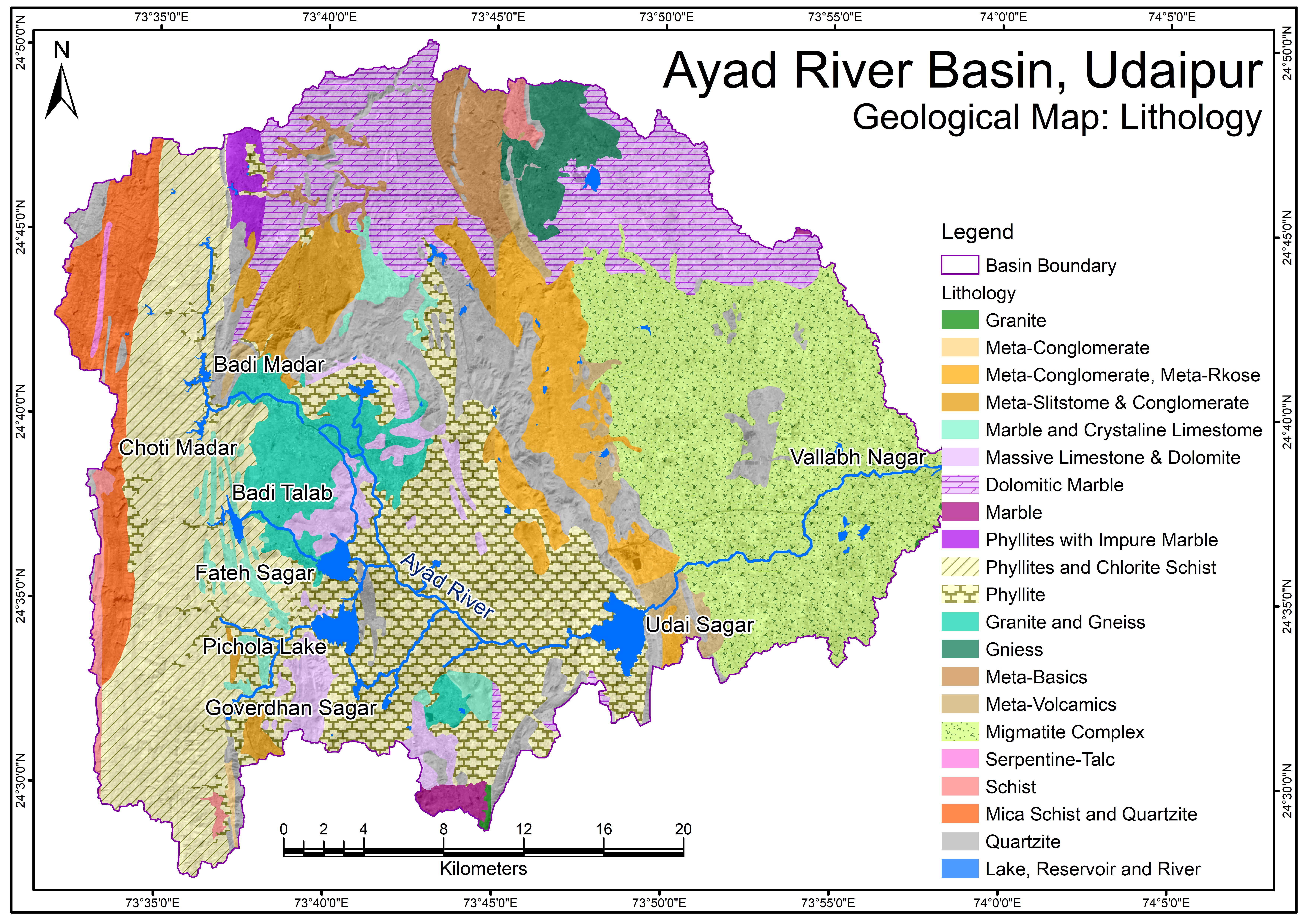
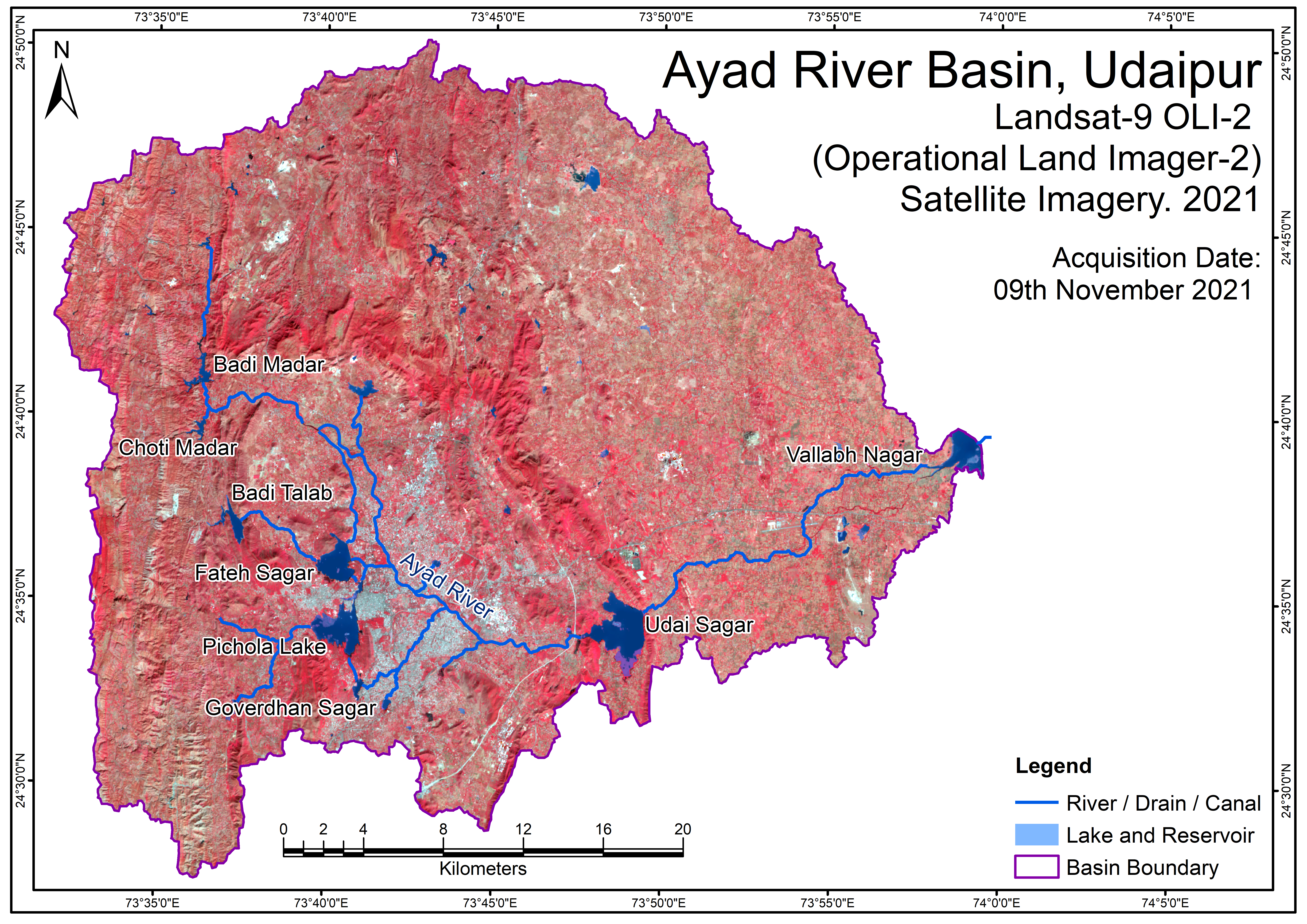
Source: The general geological map of the Ayad river basin has been prepared by using published geological map from Geological Survey of India (GSI) (https://www.gsi.gov.in/webcenter/portal/OCBIS), and it has updated through Landsat-9 OLI-2 satellite imagery (30 m spatial resolution), SRTM DEM data (30 m spatial resolution), and Survey of India (SoI) topographical map at 1:50,000 scale with limited field check.
Tags
Drainage Density Map Drainage Network Map Geological Map - Formation Geological Map - Lithology GroundWater Fluctuation Map v2 Hydrology of Ayad River Basin LandUseLandCoverMap 2011 LandUseLandCoverMap 2021 River Discharge Data Locations Satellite Imagery Map 2011 Satellite Imagery Map 2021 Soil Map v2 Unconfined Aquifer Map Satellite Imagery Map Soil Map Topography (DEM) Map
 Map.png)
Related images
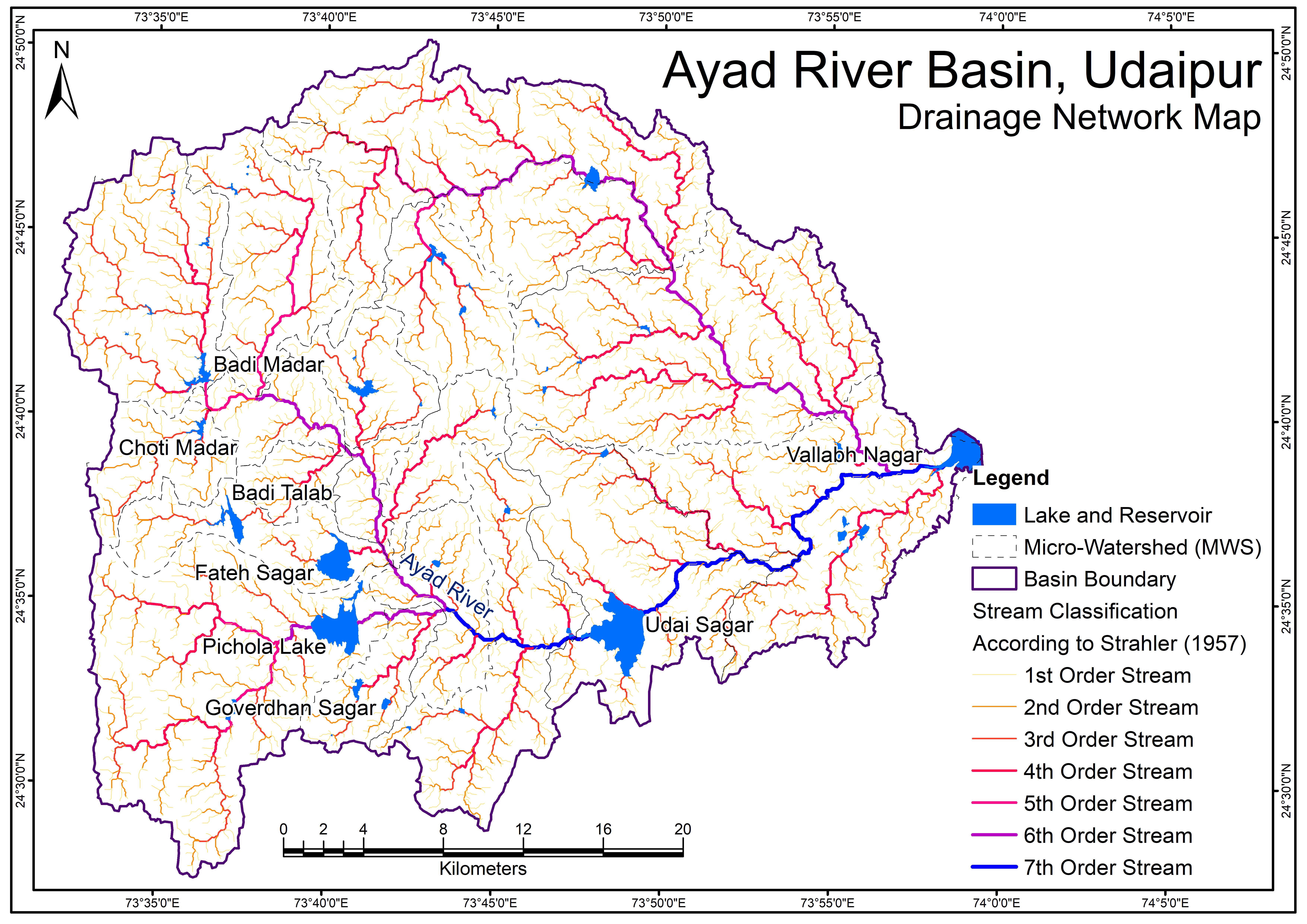
Ayad River Basin Drainage Network Map
View more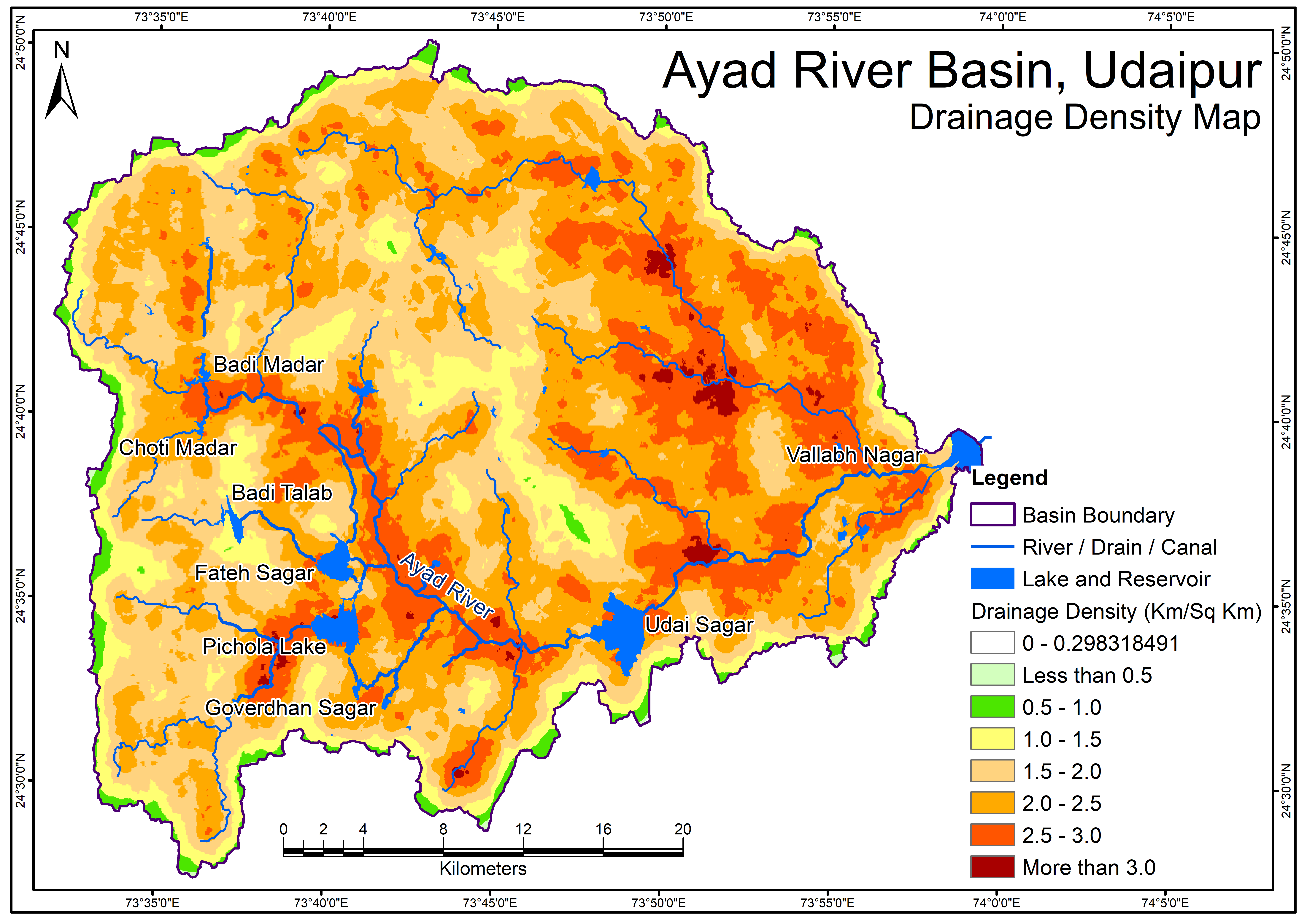
Drainage Density Map
View more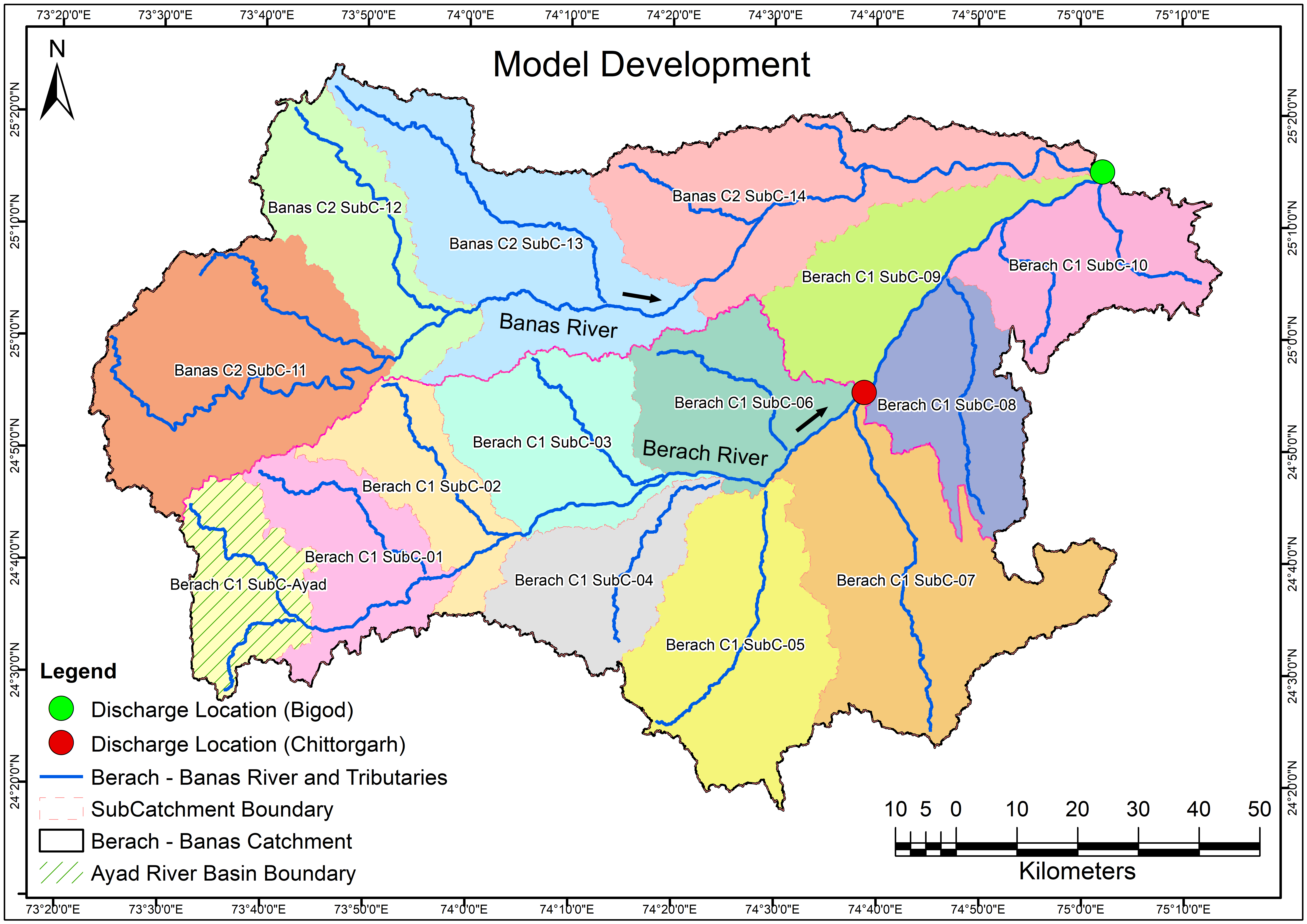
Model Development
View more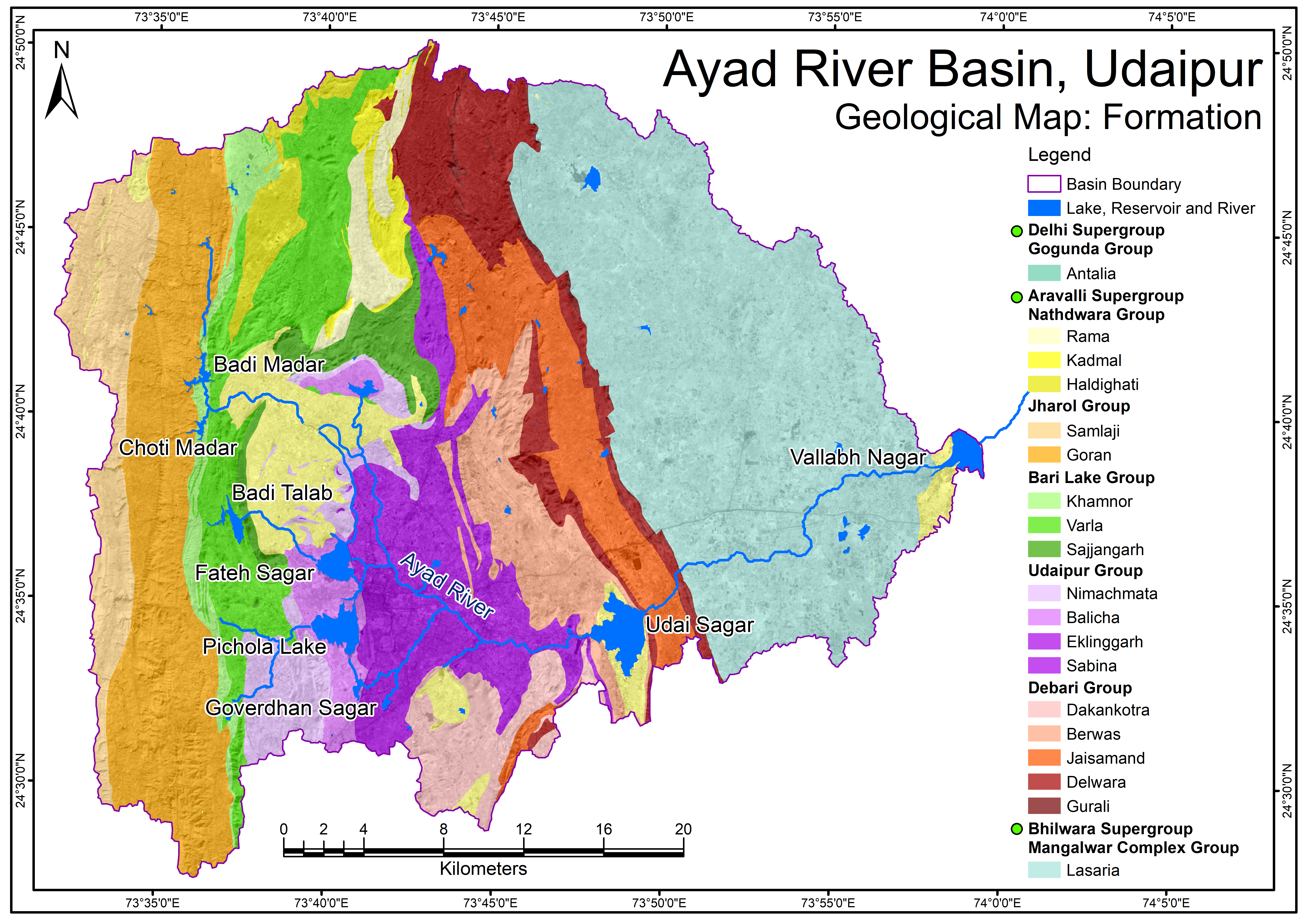
Ayad River Basin Geological Map - Formation
View more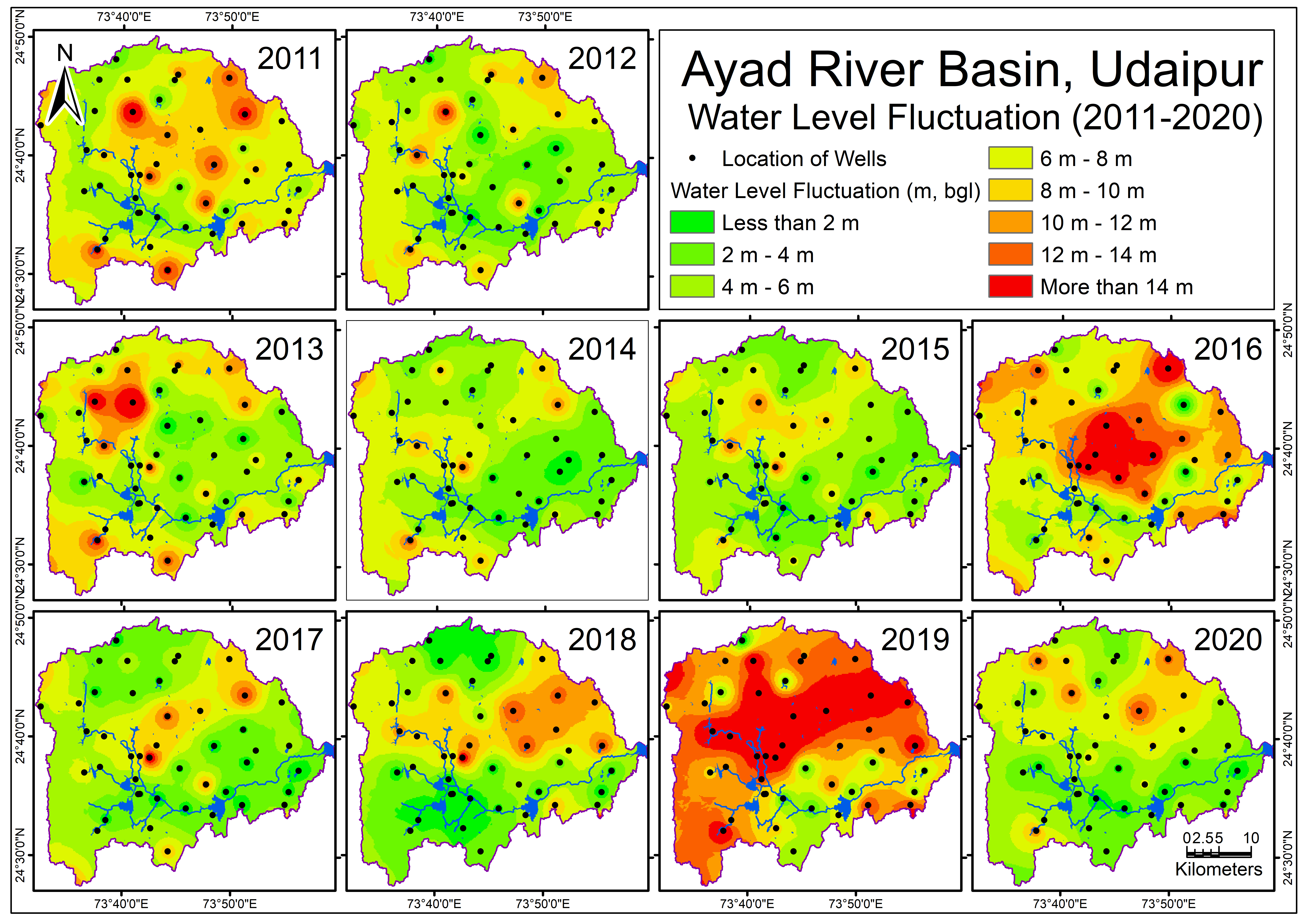
Ayad River Basin GroundWater Fluctuation Map v2
View more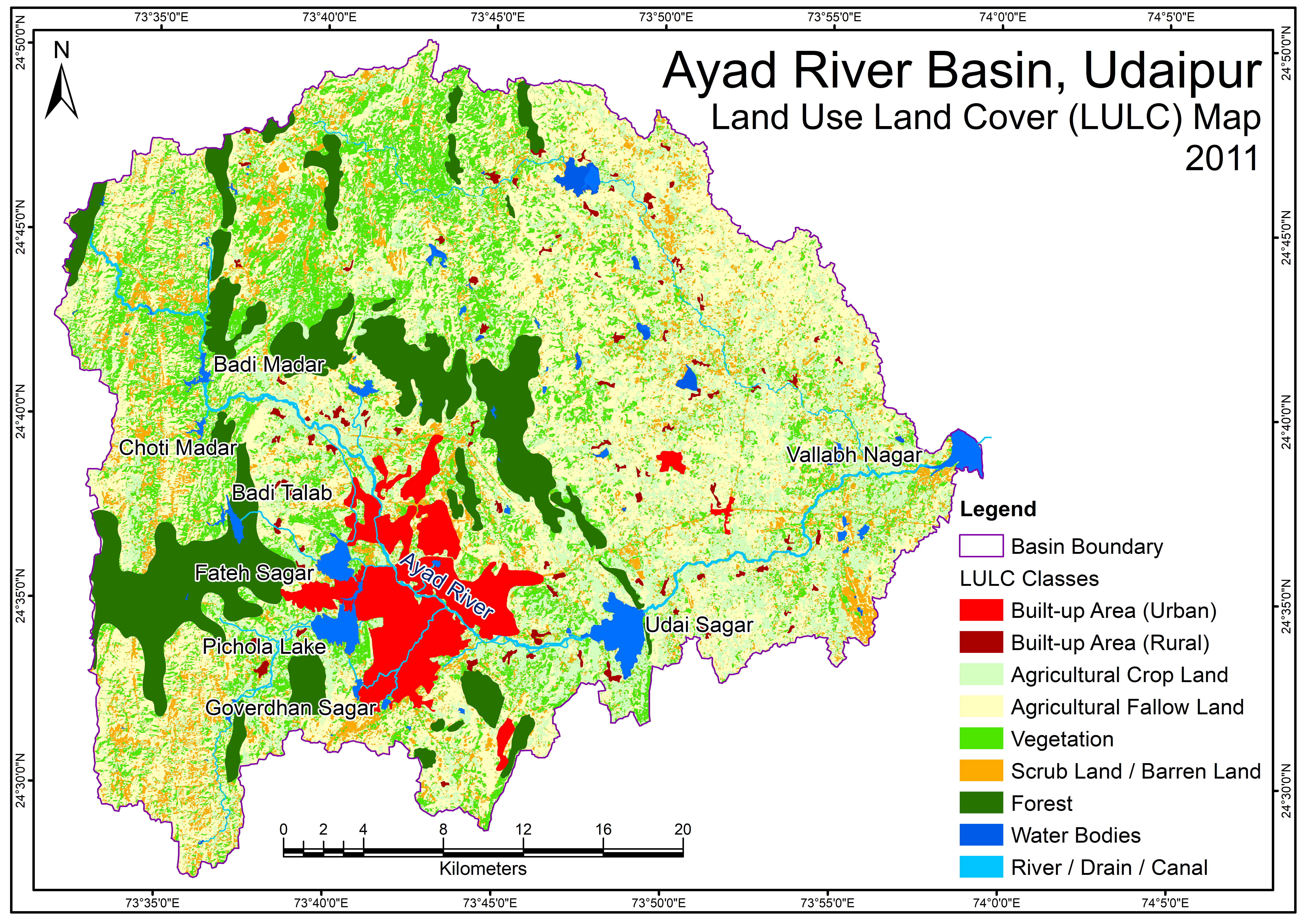
Ayad River Basin LandUseLandCoverMap 2011
View more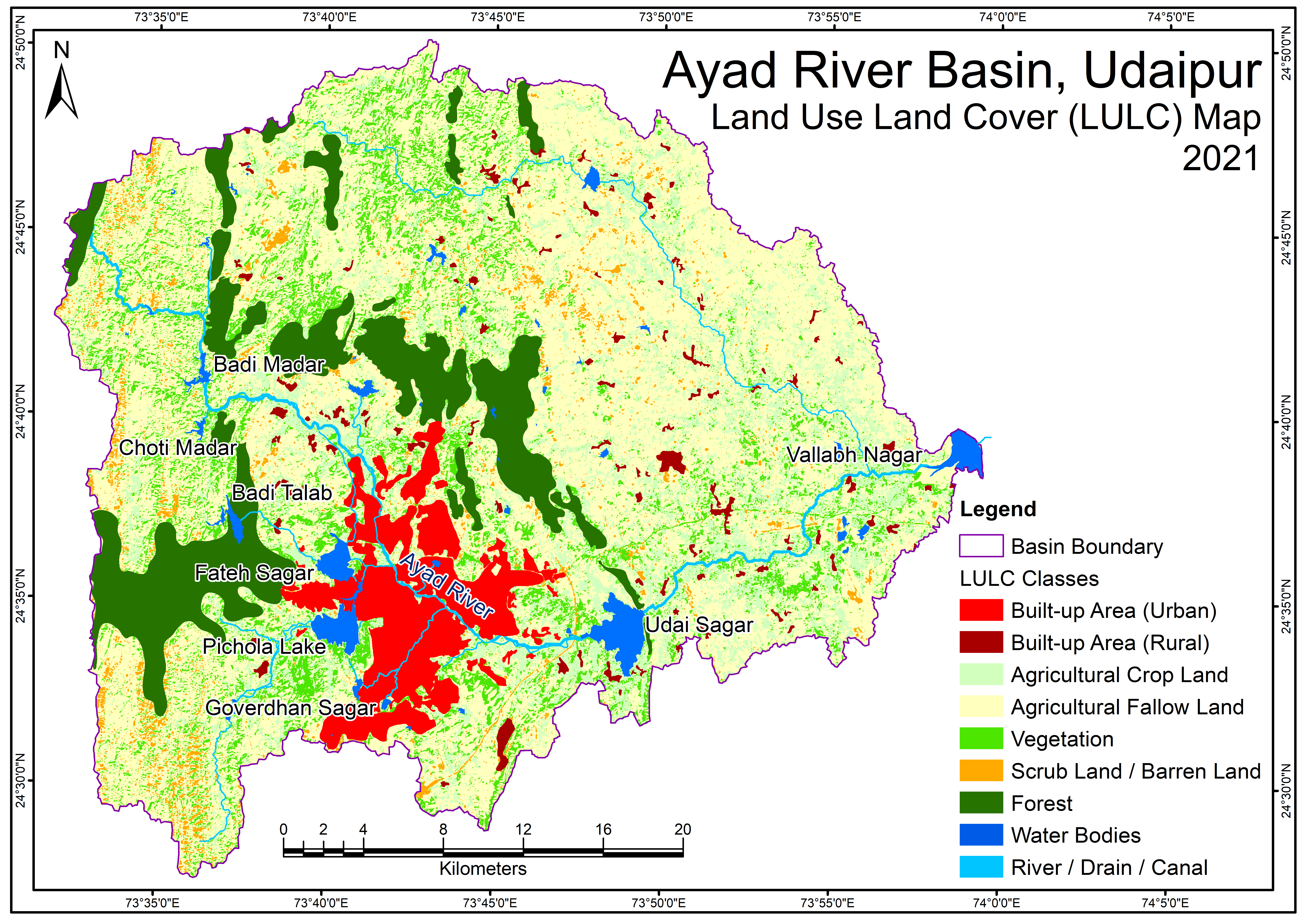
Ayad River Basin LandUseLandCoverMap 2021
View more